


Time: 1hr 55min
Distance: 69km
The Avon Crossings 4WD touring route runs between the Avon – Mt Hedrick Scenic Reserve and State Forest that joins the Avon Wilderness and the Alpine National Park to the north. The Department of Environment, Land, Water and Planning (DELWP) manage the area. The Avon River has its headwaters on the southern slopes of Mt Wellington with the tour crossing the Avon River at both Huggetts Crossing and Wombat Crossing.
Check out Forest Fire Management for more information on the Avon Crossings 4wd Tour
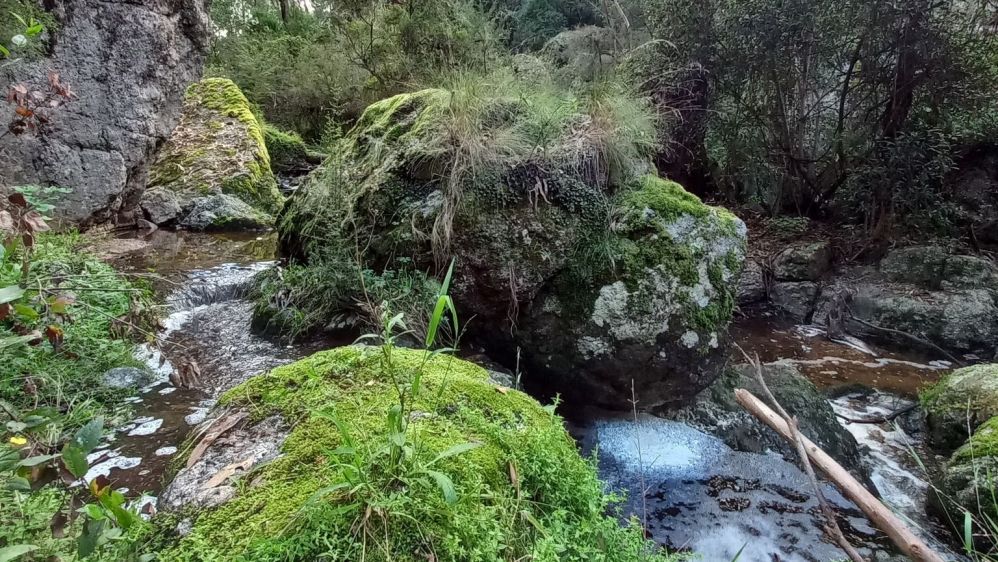
Nicholson Rocks, previously Nicholson Gorge was once a popular spot for horse riding groups and picnic parties in the late 1800s and early 1900s. The creek is frequently dry but is a spectacular sight after rainfalls. There is a short walk to Nicholson Rocks - beginning opposite the picnic area, meandering through the bush to large outcrops of boulders and along the top of the gorge. A side track will lead you down to a narrow gorge.
At Green Hill Lookout there is a small car park and picnic area. Looking north from the lookouts rocky outcrop there is a view into the Avon River Valley and the sandy area that is part of Huggett's Crossing. From this point the route is graded as medium difficulty.
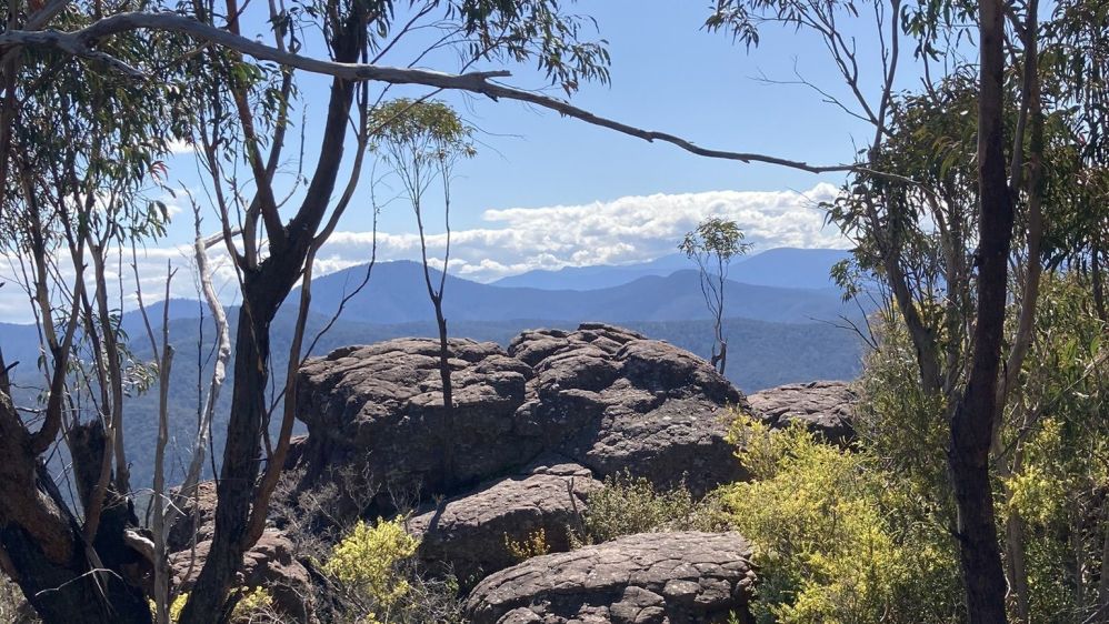
Huggett's Lookout is a rock shelf outcrop that offers stunning views to the mountains and hills to the west. There is a picnic table and often a wide variety of wild flowers in bloom.
Along the banks of the Avon River at Huggett's Crossing there are some excellent small camping areas, with a toilet on the northern edge of the large camping area. Bollards and large rocks have closed off informal tracks that were creating erosion issues along the river. Upstream from the camping areas there is an excellent deep swimming hole with a rock wall backdrop.
There are 2 crossing points of the Avon, and both have firm and rocky bases. Directly across from Huggett's Crossing is the the deeper option and a short distance downstream you'll find a shallow crossing over some red rocks.
From the helipad, enjoy views into the mountains or over dairy farming country, with the township of Maffra in the distance.
This crossing has a firm river rocky base, there are 2 options for crossing with one deeper than the other. Enjoy a swim as there are several ideal spots to have a dip near this crossing.
After leaving Wombat Crossing take O'Keefe Road which becomes Back Wombat Road to Luckmans Lane and to the town of Boisdale.