

Five clans of the Gunaikurnai nation: Bratwoloong, Brayakooloong, Tatungooloong, Brabawooloong and Krowathunkooloong have inhabited the Gippsland region for over 30,000 years.
Time: 5hr 40min
Distance: 402km
Located at Napier Rd, Won Wron
Perhaps the biggest story to come out of Gippsland in the 1840s was the search for a lost white women said to have been held captive by some Gunaikurnai people.
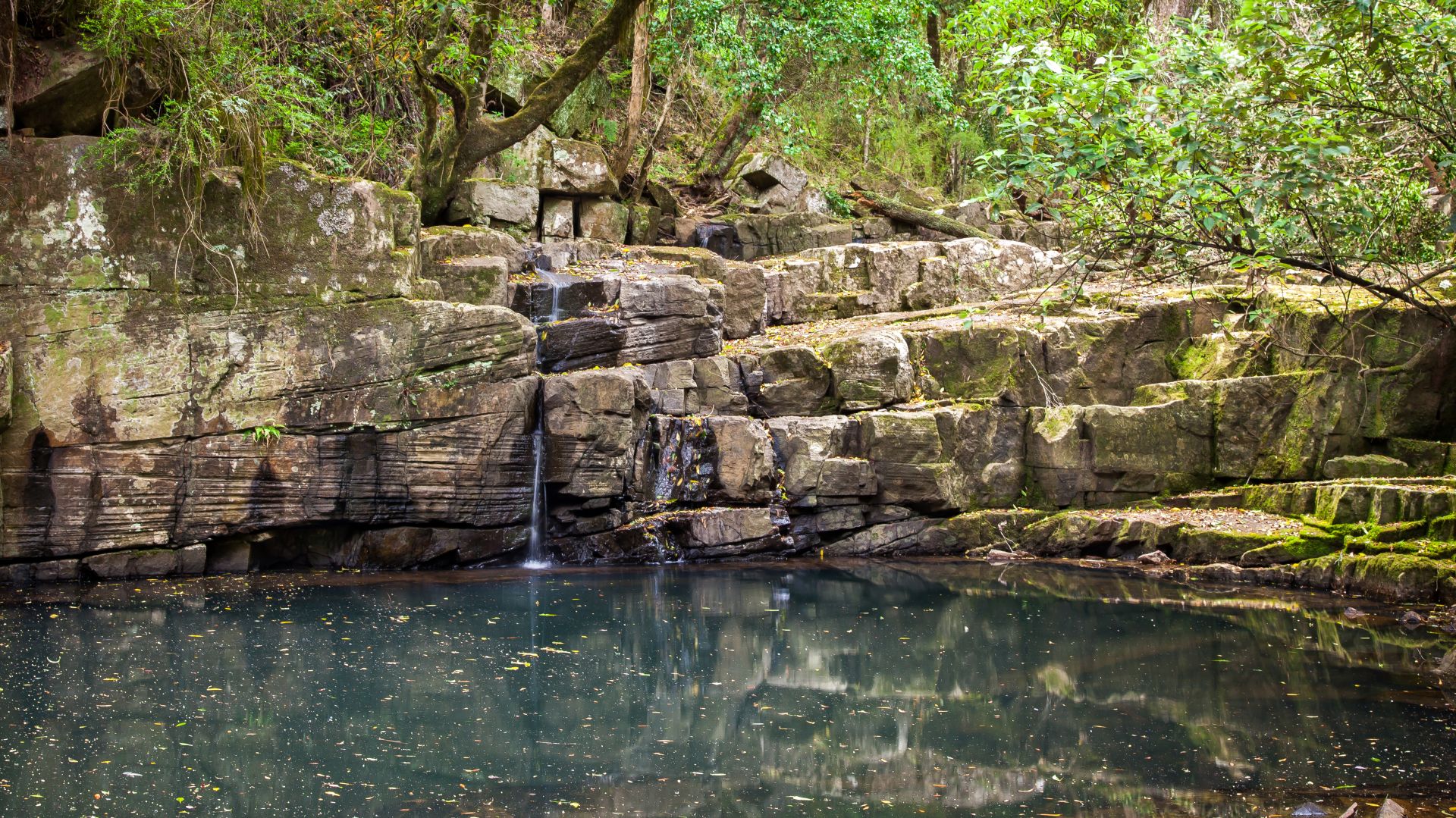
Local legend has it that in the 1840s, a young woman, the sole survivor of a shipwreck off the nearby Ninety Mile Beach was taken and held captive by the local tribe of Bratwoloong, who inhabited this part of Gippsland.
The story of the captive white woman developed a life of its own, spawning numerous myths, with various versions even claiming a sighting of a white woman being hurried away.
The White Woman’s Waterhole commemorates the tragedy of this story.
Located at Princes Hwy, Sale
Like a Supermarket.
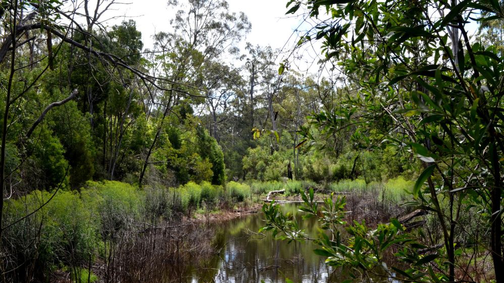
The Sale Wetlands may be reached either via Lake Guthridge, which is right beside the Princes Highway/South Gippsland Highway intersection in Sale, or by turning off the South Gippsland Highway about 1km out of town. The turnoff is well signposted. Further information may be obtained at the Sale Visitor Information centre.
The wetlands were like a supermarket for the GUNAIKURNAI people of the area. A walk around Lake Guthridge to the Sale Common boardwalks reveals numerous plants and birds which were sources of food and other important raw materials.
Located at Old Redbank Rd, Stratford
The Knob Reserve is a small but significant site on Brayakaulung Country, 3km from the township of Stratford, which is owned by the GunaiKurnai people and jointly managed by GunaiKurnai Land and Waters Aboriginal Corporation and the Victorian Government.
In recognition of its significance to Gunaikurnai people, the Knob Reserve was chosen as the place where our 2010 Native Title determination was signed, and many family days and cultural festivals are still held at the site.
Because of the high concentration of artefacts in the Reserve and surrounding areas, our primary aim is to manage the impacts of users of the Knob Reserve in a way that protects our cultural heritage values and doesn’t cause harm.
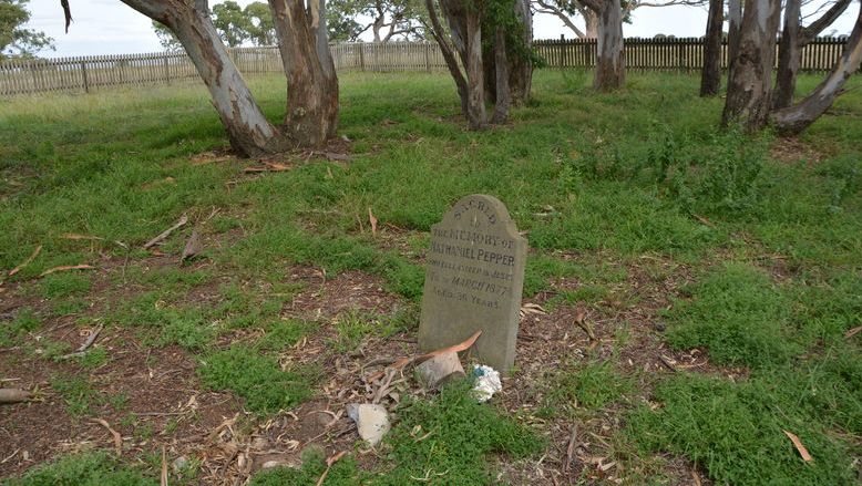
Located at Ramahyuck Cemetery Rd Perry Bridge
In the early 1860s the Moravian missionary, Frederick Hagenauer established a mission station on the Avon River near Lake Wellington. Hagenauer named the mission Ramahyuck; Ramah: Hebrew for ‘home’ and yuck: Aboriginal for ‘our’.
At Ramahyuck the Gunaikurnai gave up their freedom and culture for (as the Europeans saw it) protection, food and Christianity. Hagenauer was hardworking and authoritarian and did not allow any tribal customs or ceremonies.
Very little remains of Ramahyuck Mission Station today, from a property of over 2000 acres only the cemetery is left.
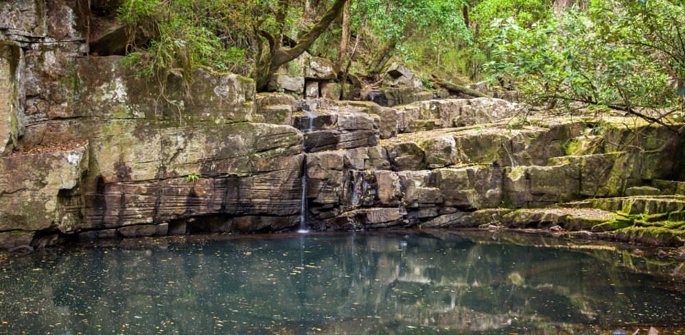
Located at Mitchell River Walking Track, Iguana Creek
The Nargun is a large female creature who lives in a cave behind a waterfall in the Mitchell River.
The Den of Nargun is a place of great cultural significance to the Gunaikurnai people, especially the women.
Traditionally Gunaikurnai men were not allowed down to the Den of Nargun or the Woolshed Creek valley. Gunaikurnai men respected this traditional law and still do today. Please treat this place with respect.
Stories were told around campfires about how the Nargun would abduct children who wandered off on their own. The Nargun could not be harmed with boomerang or spears. These stories served the dual purpose of keeping children close to the campsite and ensuring that people stayed away from the sacred cave.
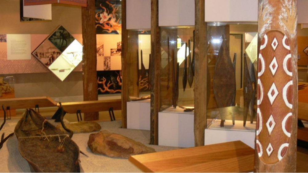
Located at 37-53 Dalmahoy St, Bairnsdale
The Krowathunkooloong Keeping Place is named after one of the five clans of the Gunaikurnai, who occupied the Orbost area.
Visitors to the Keeping Place can learn, understand and appreciate the history of the Gunaikurnai people through guided or self-guided tours of the museum. The display includes traditional hunting and fighting weapons, bark canoes, baskets, fishing spears, boomerangs and an exhibition of contemporary Gunaikurnai art. There are staff members on hand to answer questions.
The Keeping Place is located at the western end of Bairnsdale. Signposts clearly indicate where to turn off the Princes Highway. Open Monday to Friday from 9am to 5pm. Group bookings may be made on 03 5152 1891.
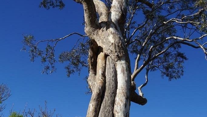
Located at 5 Princes Hwy, Bairnsdale
Howitt Park is located beside the Princes Highway at the eastern end of Bairnsdale, across the Mitchell River.
On a small rise overlooking Wahyand (Mitchell River) the men made a canoe. The 4m long scar made when the bark was peeled away can still be seen on the tree in Howitt Park. It is believed that this tree is approximately 170 years old.
The scarred tree at Howitt Park is a canoe tree and is protected under the Aboriginal Heritage Act 2006. The stand out features are the height and size of the scar on the tree.
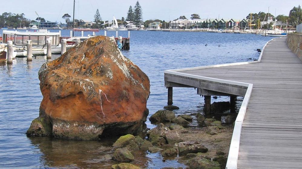
Located at 110 Metung Rd, Metung
The Legend Rock, an important part of Gunaikurnai mythology, lies in shallow water by the shore of Bancroft Bay, opposite the Metung Yacht Club in Tatungooloong Country.
The Legend Rocks hold great spiritual value to the Gunaikurnai people and the story serves as a great legend for its people to remember the laws of the land.
There were originally three rocks in the formation at Metung, unfortunately two were destroyed during road construction along the shore of Bancroft Bay in the 1960s. The last rock was preserved when community members and Gippsland & East Gippsland Aboriginal Cooperative had an injuction issued. The Legend Rock continues to be protected under the Heritage Act of Victoria.
Turn off the Princes Highway at Swan Reach and follow the Tambo River, well signposted.
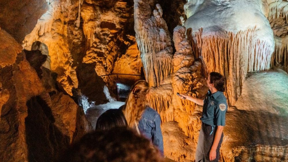
Located at Caves Rd, Buchan
Archaeology has shown that Aboriginal people have lived in the Buchan region for around 18,000 years.
Traditionally Gunaikurnai people did not venture deep into the limestone caves at Buchan. There were, however, many stories about the wicked and mischievous Nyols which lived in the caves below the earth. Tribal memories of that time may be detected in the story which concerns a group of children who inhabited this area when there was known to be a land south of Gippsland where there is now sea (ie Tasmania). When playing they found a sacred object which they took home and, against traditional law, showed to the women. Immediately the earth crumbled away and it was all water and many people were drowned.
Staff at Buchan Caves run regular tours into the caves throughout the year.
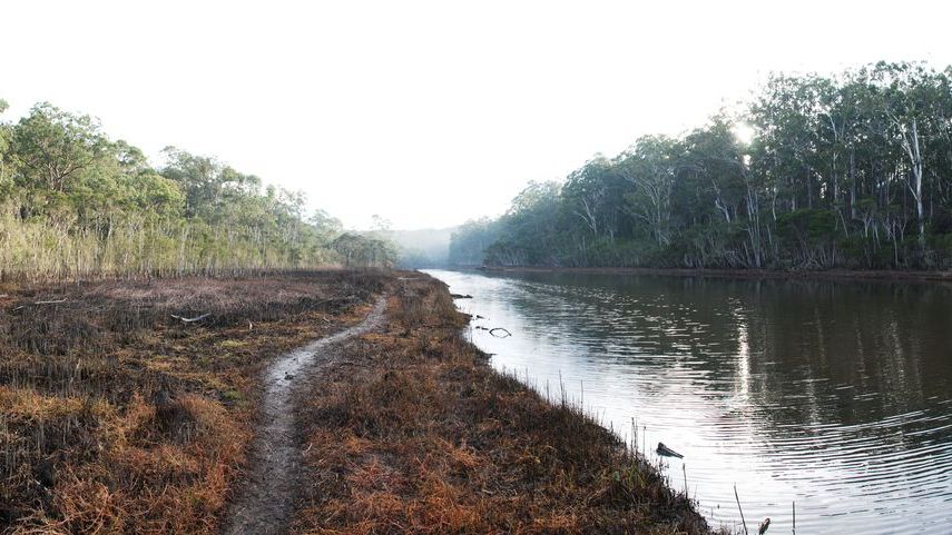
Located at Burnt Bridge Rd, Toorloo Arm
Located down a signposted turn-off from the Princes Highway between Lakes Entrance and Nowa Nowa, the Reserve is situated adjacent to land belonging to Lake Tyers Aboriginal Trust. A display centre on site provides information about Lake Tyers.
The Burnt Bridge area was a bush pantry for the Krowathunkoolong clan. Many plants and animals were used for food and medicines and to produce woven baskets and nets and in the manufacture of tools and weapons.
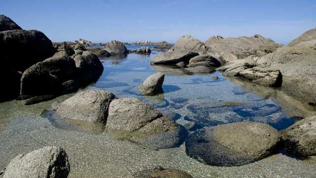
Located at Cape Conron
Turn south off the Princes Highway at Orbost to Marlo. From there take the Conron Road east to the Cape.
The viewing platform at Salmon Rock is built above an Aboriginal shell midden; the top layer is visible. A shell midden denotes a special site or meeting place where people have gathered regularly for many generations to feast, celebrate and perform ceremonies. Middens in East Gippsland have been dated at over 10,000 years old. Even today, Cape Conran remains a special place for the Gunaikurnai people of the area to visit throughout the year.