

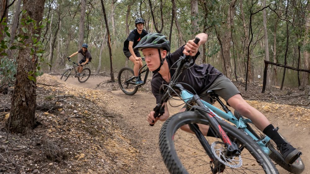
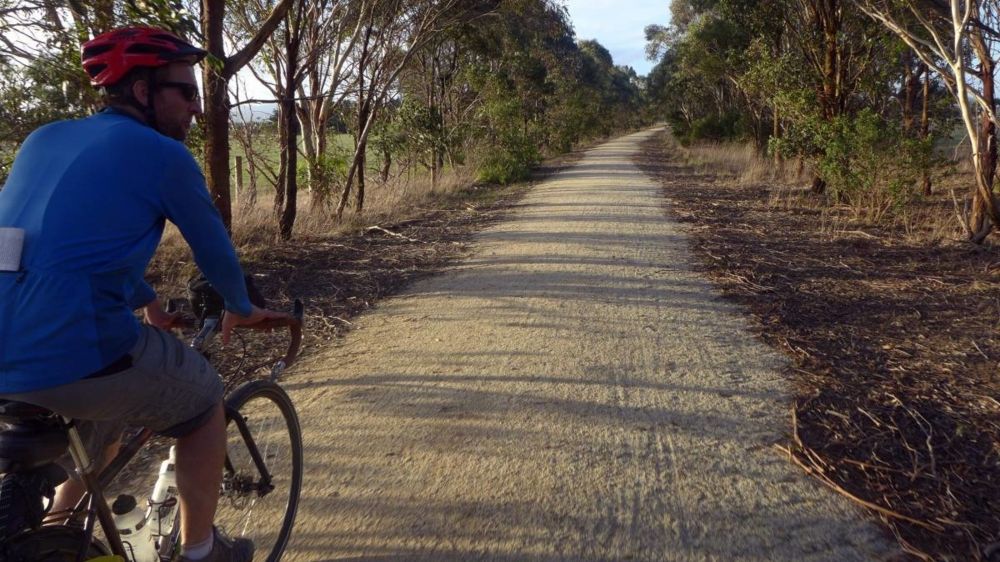
Are you ready for a high adrenalin thrill ride?
Well Blores Hill Mountain Bike Park is the spot for you.
Set on approximately 50 acres of land managed by Parks Victoria and maintained by Gippsland Mountain Bike Club, Blores Hill MTB boasts an array of trails specifically designed for mountain bike riders, you'll find a trail that will give you that long awaited thrill.
There are many trails and tracks that can be found throughout the park, with different styles and difficulties to suit all abilities from beginner riders, to the most experienced.
With over 25 tracks and trails, you'll find everything from jumps, bridges, rocky outcrops, technical elements and long flowing trails all situated throughout beautiful bushland to you to explore.
Blores Hill is one of the best mountain bike areas in Victoria with riders coming from all over the state to ride there. Not only for experienced riders Blores Hill MTB is fun for all the family and makes for an active and enjoyable day out!
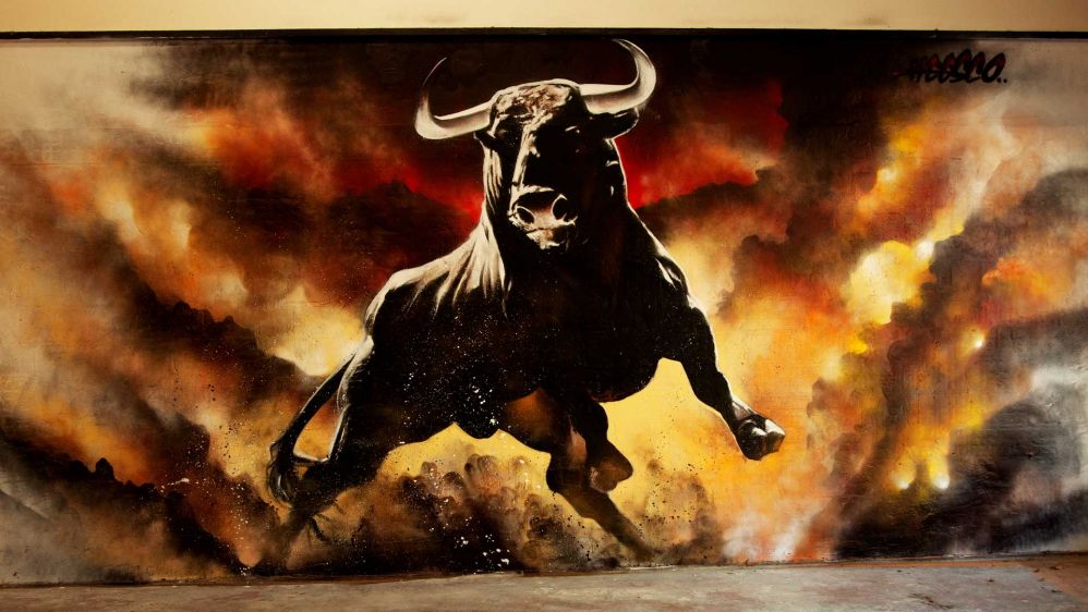
MURAL Bull Bar & Gallery
LOCATION – 258 Commercial Rd, Yarram VIC 3971 (Internal on bar walls and external rear walls of beer garden. External murals accessible from Grant Street).
“I first met Heesco when Anne and I created the now famous Artists Lane in Windsor Melbourne. Since then, Heesco and myself have completed many successful community street art projects around Victoria, so when I moved to Yarram and built the Bull Bar, I invited Heesco to come and paint the now famous Bull inside the Bar.”
WHY I BECAME INVOLVED “Heesco has been back twice since, painting the external walls in the beer garden and more recently both walls inside the dining area.
The Heesco Town concept came about after Eric Greenaway met Heesco Khosnaran at the Bar over a bottle of Shiraz. Eric quickly saw this as an opportunity to secure a famous internationally recognised artist to paint a number of highly visible building facades in Yarram, that would attract the large numbers of Australians and International tourists who follow ’Silo Art’ and ’Street Art’, especially art done by Heesco.” Wayne Tindall – Artist/film maker
ABOUT THE MURAL – The Bull Bar & Gallery is a welcome addition to Yarram, a beautiful historic town the heart of Gippsland.
Founded by artist Wayne Tindall with his film maker wife Anne, the Bull Bar is a thriving social, gastronomical and live music hub.
Yarram is a major service centre for coastal communities in Gippsland, located south of the Strzelecki ranges Ranges, east of Wilsons Promontory, and inland from the historic Port Albert.
The Bull Bar & Gallery is committed to this vibrant part of Victoria sourcing a great selection of craft beers, wines, local in season produce and stunning cheeses from all over the Gippsland region.
The Bar features stunning artwork by world famous street artist Heesco Khosnaran both on the inside and external walls.
You could be mistaken for thinking you were chilling out in a funky cafe or bar in the heart of Brunswick, Fitzroy or St. Kilda. A little oasis with a great vibe…just get yourself here!
Situated just north of the township of Briagolong, along the southern fall of the Great Dividing Range lies the Briagolong State Forest. The Briagolong State Forest has a rich history, with the original inhabitants of the region, the Briakoloong People, using the vast forest resources for building of canoes and shelters, as well as sourcing food, clothing and tool making. The early European explorers relied heavily on Koori guides during the exploration that was responsible for the opening up of the region. In the late 1800’s, these forests teemed with prospectors searching for that ever-elusive gold to bring them instant wealth.
Evidence of Aboriginal occupation can still be found today throughout the area with the recording of many archaeological sites including scarred tress, grinding grooves and artefact scatters. The Freestone Creek, Lees Creek and Granite Creek areas were the location of several alluvial gold mines. These were first discovered in the mid-1860s and though not highly profitable, continued to be worked into the twentieth century. During the late 1800s and early 1900s, a track existed to service the needs of the miners, connecting Briagolong and Gladstone Creek to the goldfields at Lees Creek and Granite Creek.
Nowadays, the Briagolong State Forest is home to fantastic bush-walks, with picnic and camping spots available for use to the public, and is known for the Blue Pool, a gem deep in the bush, that is now a beloved swimming hole that was formed in a basalt gorge.
The Sale Common Wetlands and River Heritage Trail offers a kaleidoscope of riverine and wetlands scenery in addition to heritage places, all marked with interpretive plaques. The trail begins at the Port of Sale and extends as far south as the celebrated Swing Bridge at the junction of the Thomson and Latrobe rivers.
The return journey, if you so choose, takes in Sale’s beautiful lakes – Guyatt and Guthridge, as well as the historic Powder Magazine. The historic Port of Sale was formerly the shipping terminal for so much cargo and so many passengers, either coming into Gippsland or leaving Gippsland by rail for Melbourne. The Port is found at the head of the Sale Canal, which was originally dug by horse and scoop in the late 1880s, as the essential transport link between rail and road and the rivers and lakes.
Today this historic port is a picturesque marina in a serene, landscaped setting, where you can find many walks, and outdoor spaces to enjoy.
From the Port you walk through an avenue of trees alongside the Canal, sensing not only the riverboat traffic of yesteryear, but also the festivities of rowing regattas still held today. Soon you reach McArdell’s Gap, a cut in the bank of the Canal, opposite where the Thomson River breaks into the artificial waterway. At McArdell’s you will see the site of shipyards where two of Gippsland’s most important steamboats were built – the Enterprise and the paddle steamer Tanjil.
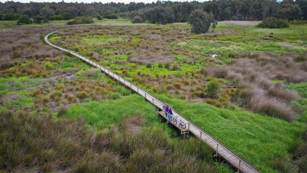
Using the updated walking tracks, you'll cross what used to be the South Gippsland Highway (now using a roadway above), you enter the incredible wonderland of the Sale Game Refuge, in earlier times known as the Sale Common. This portion of the trail, much of it over a boardwalk of generous size, spanning extensive, Ramsar-listed wetlands, is full of surprises: a tree-lined natural lagoon, haven to so much bird life; ancient gum trees, twisted and gnarled; a blazed tree evocative of the earliest explorers of Gippsland; an old rifle butt re-incarnated as a bird hide; a large brick water trough, now incongruous in its wilderness setting, and so much more.
From there, you emerge onto a part of the Punt Lane flanking the Thomson River, so called because it led to a punt, the first river crossing linking the upper districts with Port Albert to the south. Soon you are in view of the nationally important Swing Bridge. This was completed in 1883 to the design of notable Australian engineer and bridge builder, John Grainger. The Bridge still swings open to allow vessels to enter the Port of Sale. It is a ‘must see’, not only for its historic importance but also for the extraordinary symmetry of its design, best viewed from the Longford side.
On your return you have the choice of passing by the site of Gippsland’s first licensed airfield, the superb environs of Sale’s lakes and the fortress-like Sale Powder Magazine, now fully restored. In 2009, the Institution of Engineers, Australia, recognised the Port of Sale with a Heritage Marker, and the Swing Bridge with its highest honour, a Heritage Landmark.
The Sale Wetlands and River Heritage Trail is a gentle 5.1km walk (one way) or 10.2km (return) on a gravel and concrete path way. The walk is suitable for those with prams or wheelchairs, with the paths being generally flat.
The Port of Sale to Swing Bridge section is accessible to those of all abilities, mapping can be found here
Join the lines of the Great Southern Rail Trail in Yarram, by following the Trail through to Alberton, where you can continue all the way through to Nyora in South Gippsland. Recent upgrades have connected the old Tarra Trail segment to the Great Southern Rail Trail, experience the rolling hills of the Strzelecki Ranges. The Great Southern Rail Trail connects at Alberton, where you can cycle through to Welshpool and then further afield.
The Yarram section of the Trail itself is an easy to ride or walk trail which is perfect for young children, the Trail is also close to seaside Port Albert for a post-ride meal. The trail connects with other local pathways making it possible to start or finish the trail from many locations in either town. In Yarram, the trail follows the old railway line before passing by the Yarram Wetlands and out of town where you'll take in views of the surrounding dairy farmlands. The Great Southern Rail Trail brings you through the small town of Alberton, with the Victoria Hotel well worth a stop for a bite to eat, or a cold drink to get you hydrated. The trail then continues onto the historic seaside village of Port Albert, with a history steeped in whaling, oil and gas exploration and much more. To finish off your walk, grab some fresh fish and chips and enjoy sitting by the wharf with beautiful water views.
The Great Southern Rail Trail is a fantastic way to experience Gippsland, with a wide variety of vistas to explore. From the green, rolling hills of the Strzelecki Ranges, to the wide expanse of dairy farmlands, to the historic ports of Port Albert and Port Welshpool.
For more: Great Southern Rail Trail & Tarra Trail – Rail Trails Australia
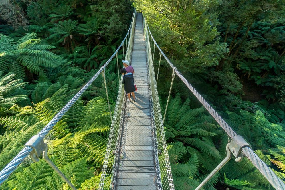
The walk is a short 1km return trip that is an easy stroll along the boardwalk around the inlet where birds feed on the foreshore. Then cross the bridge to explore a remote and wild stretch of Ninety Mile Beach.
Just 15 minutes from Yarram or 10 minutes from Woodside, McLoughlins Beach is amongst the southernmost beaches on the Ninety Mile Beach.
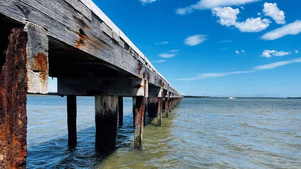
The estuary and beach make for ideal fishing spots and there is also a two ramp boat ramp for boaties, jetty and footbridge.
With plenty of bird life, native fauna,
Photographic opportunities and walking tracks, McLoughlins Beach is a fantastic day out…but bring snacks as there aren’t any shops.
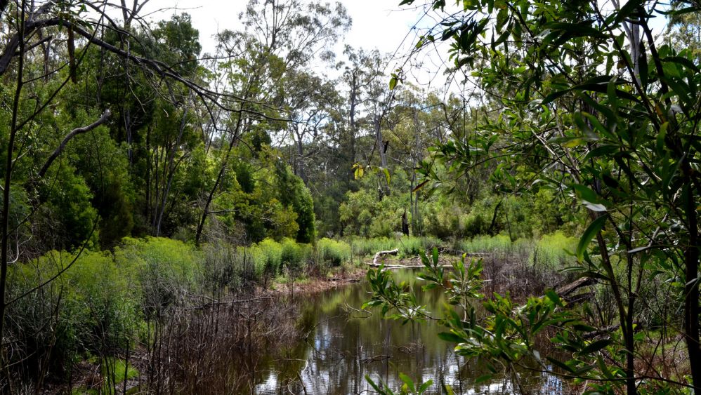
Maffra Wetlands Walk is a 2.6km lightly trafficked trail located near Maffra that features a river and is good for all skill levels. The trail is primarily used for hiking, walking, nature trips, and bird watching.
The perimeter walk around the wetlands lets you take in the tranquillity of the surroundings and there is an abundance of beautiful bird life, native flora and other fauna to be viewed on this picturesque walk.
With gentle hills and no steps, the track is a combination of boardwalks and gravel and is suitable for even the most inexperienced walker.
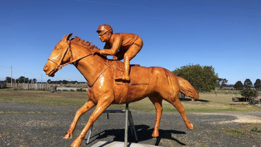
With 35 years' experience in wood carving, John Brady's Wood Sculpture Gallery is sure to intrigue you. With intricately detailed works formed by chainsaw, John's pieces can be found all across the world, including right here in Gippsland!
John Brady has had The Man from Snowy River, Banjo and Slim in his hands; he’s competed alongside Bradman; and he’s spent time with RM Williams, Henry Lawson and Roger Federer. He’s shaped the dancing stance of an Aboriginal warrior. As well as personally knowing the late Slim Dusty, he has depicted him and plenty of others in wood and in ice, such as actor Tom Burlinson chasing brumbies down the side of an alpine mountain.
But it’s through his moving statuesque tributes to Australia’s defence force personnel and families that John has come to public attention. His longest enduring monuments are in a World War I avenue of honour along the Lakes Entrance esplanade. He carved out of cypress trees Simpson and his donkey with a wounded soldier, a woman and her children waiting, a soldier and a nurse. There’s also a fisherman, in tribute to the region’s history. That was 21 years ago. He still receives commissions for war memorials from all around Australia.
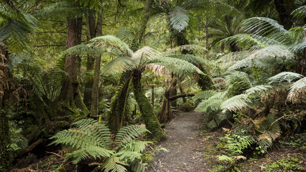
The Tarra Valley loop is is a wondrous hike through the magnificent Tarra Valley, home to some of the best primeval rainforest in Victoria. This trail features an array of waterfalls, including Cyathea Falls and Tarra Falls, and many endangered Slender Tree-ferns (Cyathea cunninghamii), as well as ancient specimens of Myrtle Beech (Nothofagus cunninghamii).
There's a great picnic area in the Tarra Valley - perfect for a quiet lunch with your friends and family. During the walk you'll have great views of the Ninety Mile Beach and surrounds, as well as the chance to observe the recovering native forest, decimated by the 2009 Black Saturday bushfires.
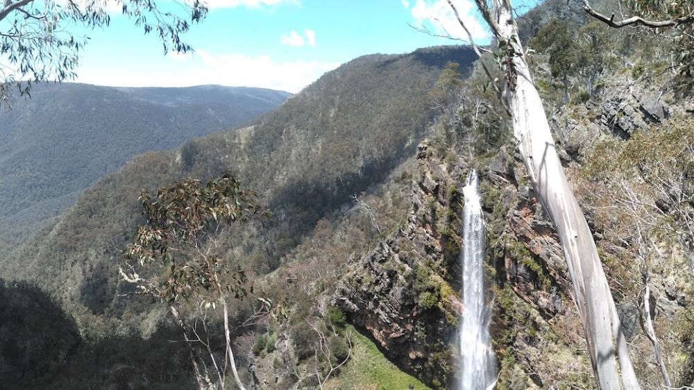
The Bryce Gorge Circuit hike starts at the carpark on the Howitt Road, 23.5km north of Arbuckle Junction (46.5 km north of Licola via Tamboritha Road). From the carpark follow the well defined track across open snow plains for about 1.7km to the waterfall on Pieman Creek. The best view is from a lookout about 50 metres beyond the sign.
Return to the main track and continue around the clifftops of Bryce Gorge for 2 km to Conglomerate Falls. From the falls the track follows Conglomerate Creek through Black Sallee woodlands and across open plains to a junction with the Wonnangatta Track. Guy's Hut is reached a further 3 km though groves of Snow Gums. Built in 1940, the hut is an excellent example of bush architecture and well worth a visit. Continue 1 km south east from the hut to the carpark.
Bryce Gorge Circuit is a 7.6km, Grade 3 hike located in the Alpine National Park, Victoria. The hike should take around 3 hrs to complete. For detailed trail info visit Bryce Gorge Circuit (7.6km), Alpine National Park, Victoria (trailhiking.com.au)

ESTABLISHED IN 1965, GIPPSLAND ART GALLERY PLAYS A VITAL ROLE IN THE ARTS & CULTURE OF THE REGION.
The Gippsland Art Gallery is situated at the Port of Sale, overlooking stunning waterways and parkland. Every year the Gallery hosts around twenty exhibitions of local, national and international significance, in addition to ongoing and evolving displays of the permanent collection. Housed in the Wellington Centre together with the Sale Library and Sale Visitor Centre, there is always plenty to see and do!
HISTORY:
The Gippsland Art Gallery was established in 1965 as the Sale Regional Arts Centre, above the City Library in Macalister Street, Sale.
The Gallery was the first public art venue to open east of Melbourne. A Victorian State Government Grant of £20,000 enabled the construction of the Gallery, which was initially operated by a Committee of Management. The Gallery was staffed entirely by volunteers until its first Director, Gwen Webb OAM, was appointed in 1976. It continued to operate as a community gallery until 1994, when it came under the management of the newly formed Wellington Shire Council. The Gallery relocated to the Port of Sale Civic Centre, where it reopened in 1995.
GALLERY REDEVELOPMENT:
In July 2015 the Gallery commenced a major, $14.53 million redevelopment, funded jointly by Federal, State and Local Governments, in addition to a $1.5 million gift from the John Leslie Foundation. The redevelopment has dramatically enhanced the visitor experience, with increased exhibition spaces and improved access to the Gallery collection. The new Gippsland Art Gallery opened to the public on 6 January 2018.
Features of the new Gallery include access to the art reference library, The Dock Cafe, Gallery Shop, and a dedicated showcase for the celebrated Sale-based textile artist Annemieke Mein OAM.
Perhaps the biggest story to come out of Gippsland in the 1840s was the search for a lost white women said to have been held captive by some Gunaikurnai people. Local legend has it that in the 1840s, a young woman, the sole survivor of a shipwreck off the nearby Ninety Mile Beach was taken and held captive by the local tribe of Bratwoloong, who inhabited this part of Gippsland.
The story of the captive white woman developed a life of its own, spawning numerous myths, with various versions even claiming a sighting of a white woman being hurried away. This lead to search parties consisting of Angus McMillan’s men and Native Police pursuing Gunaikurnai people to try to rescue her. The woman, if she ever existed, was never found. A ship’s figurehead however, was recovered, leading to speculation that it may have been mistaken for the white women.
This White Woman of Gippsland story is believed to have been used to justify the killings of many Aboriginal people, particularly the Gunaikurnai. Massacres of the Gunaikurnai led by McMillan occurred at Nuntin, Boney Point, Butchers Creek, Maffra and at other unspecified locations throughout Gippsland. A massacre at nearby Warrigal Creek is recognised as one of the worst in Australian settlement history.
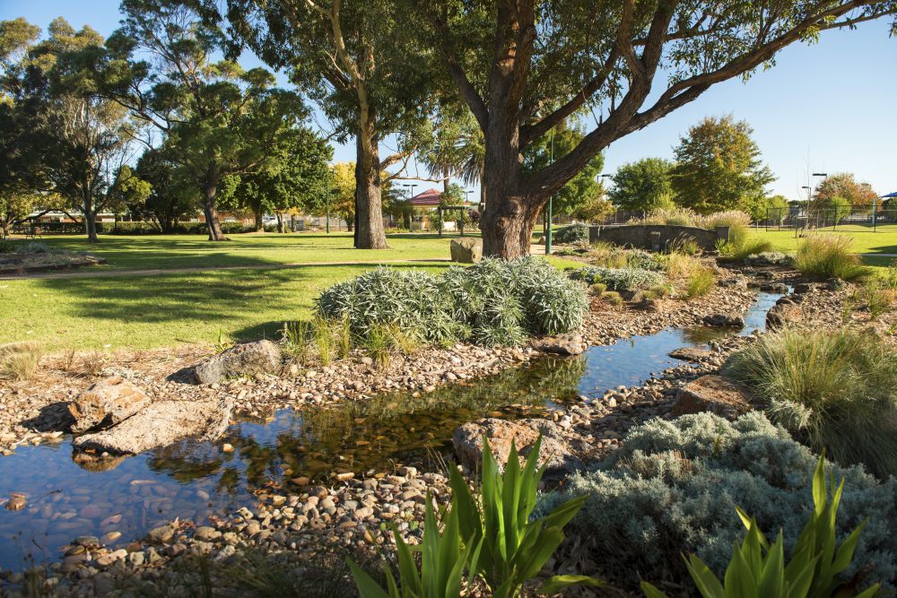
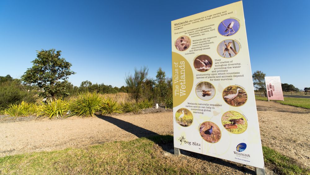
The gorgeous wetlands at Yarram provide a natural backdrop to a selection of recreation activities. Within the parklands, you'll find a basketball court, exercise park and skate park. You'll also find picnic tables and terracotta steps, so you can find the perfect spot to sit back and relax.
The Wetlands Walking Trail features a short 600m walk on gravel pathways that are generally flat and easily accessible for those in wheelchairs and prams. You'll find something for all members of the family to experience and enjoy at the Yarram Wetlands Park.
The Wetlands Park and Walking Trail also connects to the Tarra Trail. For more information on the Tarra Trail, visit The Middle of Everywhere > Tarra Trail
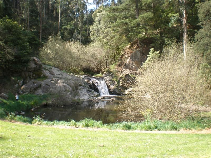
This idyllic setting in the middle of the bush has made Minneha'ha Falls a popular weekend destination. A rocky waterfall enclosed in a deep valley west of Yarram, remote but still within a few steps from the road and your campsite. Despite being only a relatively small river, in winter/spring there was a loud and powerful flow of water gushing down the near vertical rock face, into the pool below.
Directly in front of the falls there is a lawn area which makes a perfect spot to lay out a picnic blanket for an uninterrupted view of the falls from across the pool. From the adjacent car park you can also walk up a little track, past the water tank, and down the other side to the top of the falls.
Downstream of the falls next to the Albert River, you will find the campground with unpowered camping sites. The campsites are on relatively flat, open ground with a grassy covering, and come with their own fire pits and communal toilets.