

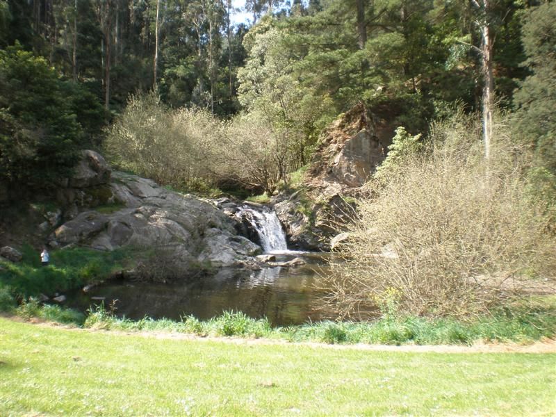
Bellbird Corner Riverside Reserve follows the route of a long-disused road between Sandy Creek Road and Lower Newry Road, Maffra, beside the Macalister River. The reserve contains 2.6 km of walking trails, comprised of gravel and dirt trails, that are generally flat.
This trail is great for hiking, running, and walking, and it's unlikely you'll encounter many other people while exploring. Dogs are welcome, but must be on a leash. Follow the flat trail along the Macalister River and Newry Creek up to Lower Newry Road and back again. Lots of wildlife in this peaceful area.
110km of walking tracks around Tarra Bulga NP and linked to Morwell NP in South Gippsland.
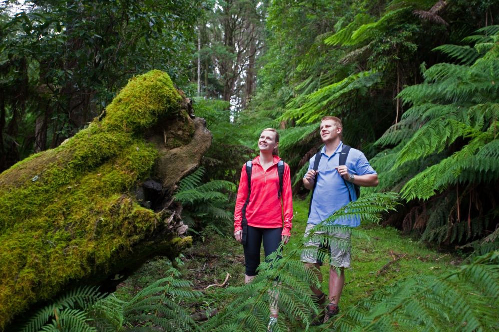
Home to the tallest flowering hardwood trees on earth, the majestic Mountain Ash makes the Strzelecki Ranges of Gippsland like no other place. These massive trees and prolific jungle-like undergrowth that cloaked these ranges became known as The Great Forest of South Gippsland, or simply The Great Forest.
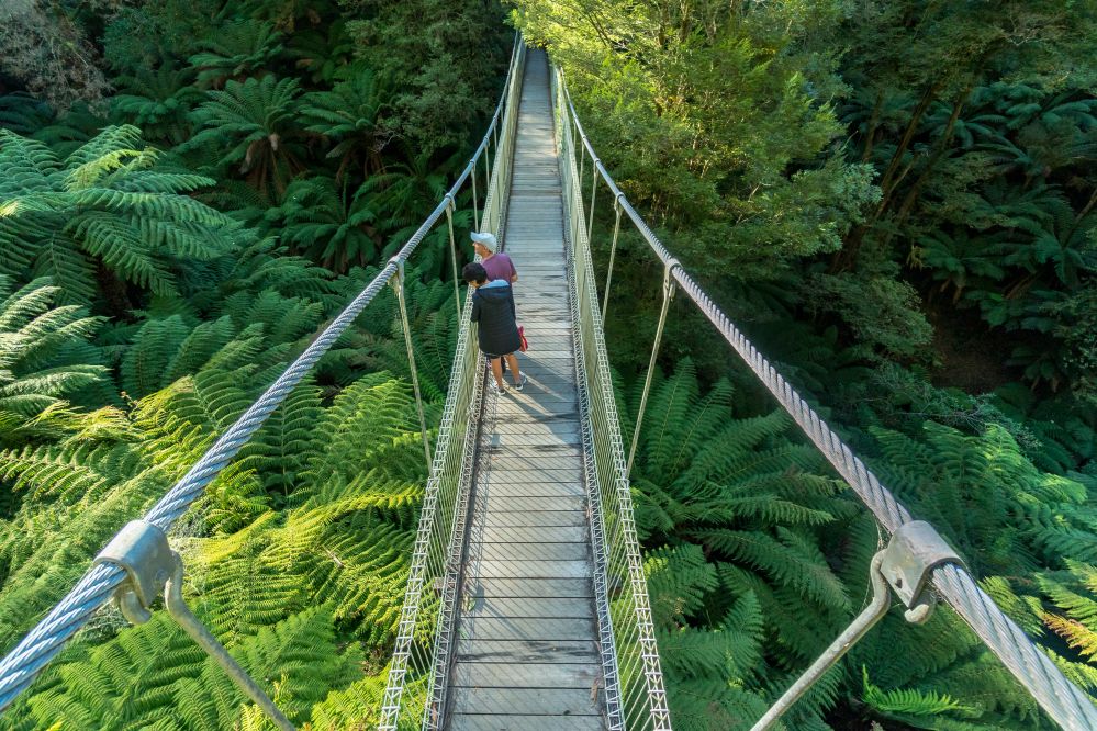
Until The Grand Strzelecki Track was built, most of these forests were inaccessible to the public except for short walks in the two national parks. Now bushwalkers can traverse from park to park and enjoy extended walks beyond park boundaries, discovering clear mountain streams, hidden natural treasures, waterfalls, sweeping views, rare and endangered ecosystems, and flora and fauna that most visitors to the region have never seen. Amongst this fauna is the South Gippsland Koala, which is a healthy and genetically intact wild koala population unique in Victoria. The Grand Strzelecki Track also reveals the amazing and sometimes tragic sawmilling and settlement history of the Strzelecki Ranges, along with recent conservation initiatives to preserve and restore our natural heritage.
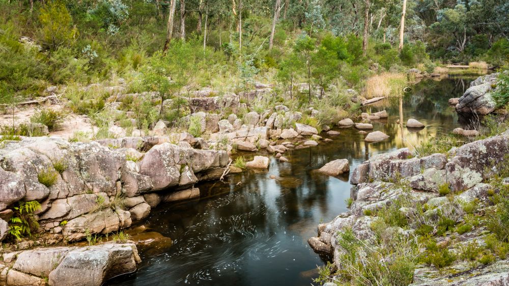
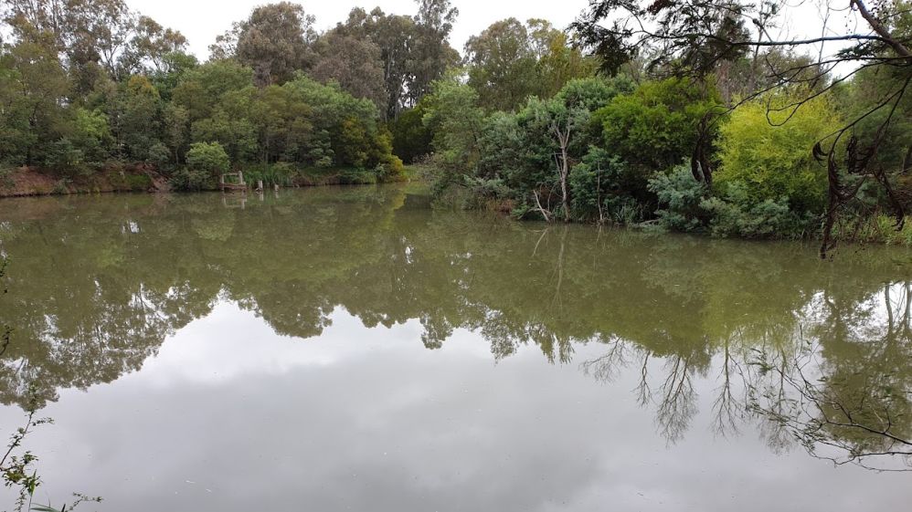
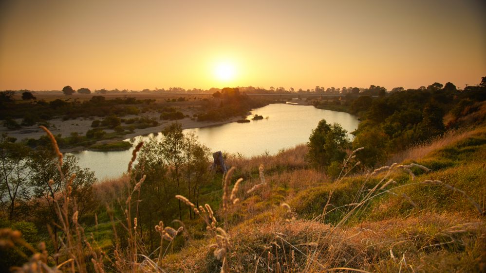
Situated north west of Maffra in the foothills of the Victorian Alps. The Avon River winds majestically through the 5700 ha. reserve, over time sculpting beautiful gorges from the surrounding landscape. Complementing this is dry open forest with a diversity of wildflowers as well as rocky escarpments and several high peaks with sweeping views of the surrounding area.
The Channel is the centrepiece of the reserve; a magnificent gorge created by the Avon River carving its way through the silt and sandstone over millennia. The steep sides of the gorge are covered in native vegetation, with shady Casuarinas in abundance. Crags punctuate the riverbed, creating a system of pools and rapids that provide important habitat for aquatic life.
The Avon Mount Hedrick Scenic Reserve also offers some great mountain biking opportunities with back country trail riding. Mostly created by motorbikes but offering a unique riding experience over rocky, technical terrain. With trails such as Middle Track, Last Hurrah, Stairway to Hell, Zimmy's Descent and Caves Track to explore, the Avon Mount Hedrick area is perfect for the adventure rider.
The reserve provides for a variety of activities including picnicking, camping, walking, sightseeing, horse-riding, fishing, swimming and car touring.
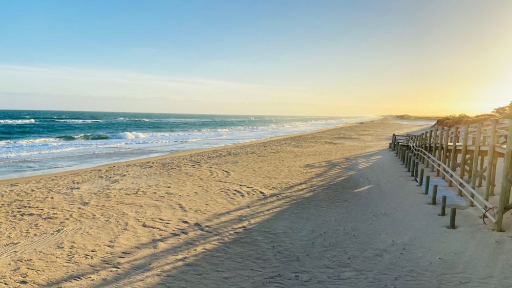
Australia’s longest Beach can be found right here in Gippsland.
From Mcloughlins Beach to the wide-open waterways of Lakes Entrance lies the Ninety Mile Beach – a pristine stretch of golden sand that separates the Gippsland Lakes from Bass Strait.
This is one of the most natural and unspoilt beaches in the world and is ideal for any number of beach activities from surf fishing to swimming or walking, seasonally whale and dolphin-spotting, building sandcastles, running up and down the dunes or just lazing in the sun.
Come for a drive an explore the coastal towns located along Ninety Mile Beach:
Just 15 minutes from Yarram, Mcloughlins Beach is amongst the southernmost beaches on the Ninety Mile Beach. The estuary and beach make for ideal fishing spots and there is also a two-ramp boat ramp for boaties, jetty and footbridge.
With plenty of bird life, native fauna, photographic opportunities and walking tracks, Mcloughlins Beach is a fantastic day out…but bring snacks as there aren’t any shops.
This tiny coastal community offers a relaxed vibe to enjoy the vast Ninety Mile Beach with patrolled swimming during the summer months. Easy beachside parking, general store for all your drink and snack needs, caravan park and the Surf Life Saving Club bar and restaurant are also open over the summer months.
With large grassy reserves, easy foreshore access, playground, toilets, barbecue and picnic facilities, Seaspray is the perfect stopover. The beach is patrolled over summer months and the Seaspray Surf Life Saving Club offer a great meal with a great view from their restaurant. Great caravan park is on offer and the General Store has brilliant fish and chips – grab some and head to the park or the beach.
Golden Beach is situated within the Gippsland Lakes Coastal Park on the stunning Ninety Mile Beach just 25 minutes from Sale.
This gorgeous coastal town offers 9-hole golf course where the main attractions are the kangaroos that inhabit the fairways with meals on Saturday nights, RV Park and general store offering great fish and chips, fuel groceries including fresh bread, liquor, bait and gas bottles.
Around 6½ kms south-west of the Golden Beach, is the Trinculo shipwreck. Be sure to stop off and take a look at her iron spine sticking out of the sand after she ran aground due to bad weather in 1858.
This hugely popular village is ideally positioned between the waters of Lake Victoria and Bass Strait. Loch Sport is one of the larger towns along Ninety Mile Beach with facilities including supermarket and many varying accommodation options. Hire a kayak and take a paddle around Lake Victoria, grab an round of golf, watch the action from the waterside Loch Sport Marina Hotel or check out one of the surrounding national parks.
The Den of Nargun is a place of great cultural significance to the Gunaikurnai people, especially the women. Traditionally Gunaikurnai men were not allowed down to the Den of Nargun or the Woolshed Creek valley. Please treat this place with respect. Stories were told around campfires about how the Nargun would abduct children who wandered off on their own.
The Nargun could not be harmed with boomerang or spears. These stories served the dual purpose of keeping children close to the campsite and ensuring that people stayed away from the sacred cave.
Featuring the Bluff lookout with views of the Mitchell River, green rainforest pockets and Woolshed Creek, the Den of Nargun Loop is also part of the Bataluk Cultural Trail, which explores Gunaikurnai Aboriginal history and culture.
Location: Mitchell River National Park
Distance: 5km return
Duration: 1 hour 30 minutes
Grade: Level 3 – Suitable for most ages and fitness levels. Some bushwalking experience recommended. Tracks may have short steep sections, a rough surface and steps.
Start: Den of Nargun picnic area
Finish: Den of Nargun picnic area
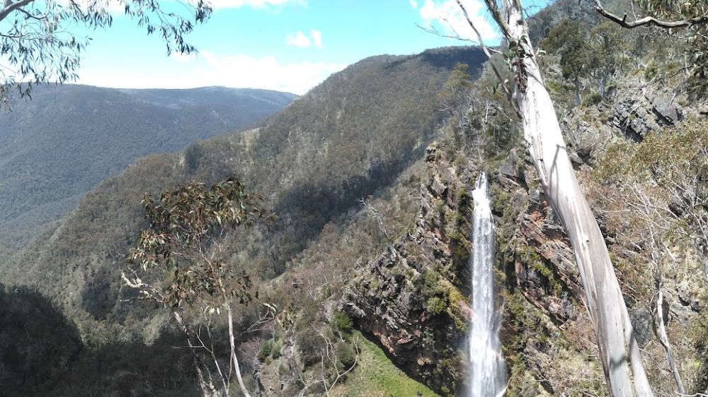
The Bryce Gorge Circuit hike starts at the carpark on the Howitt Road, 23.5km north of Arbuckle Junction (46.5 km north of Licola via Tamboritha Road). From the carpark follow the well defined track across open snow plains for about 1.7km to the waterfall on Pieman Creek. The best view is from a lookout about 50 metres beyond the sign.
Return to the main track and continue around the clifftops of Bryce Gorge for 2 km to Conglomerate Falls. From the falls the track follows Conglomerate Creek through Black Sallee woodlands and across open plains to a junction with the Wonnangatta Track. Guy's Hut is reached a further 3 km though groves of Snow Gums. Built in 1940, the hut is an excellent example of bush architecture and well worth a visit. Continue 1 km south east from the hut to the carpark.
Bryce Gorge Circuit is a 7.6km, Grade 3 hike located in the Alpine National Park, Victoria. The hike should take around 3 hrs to complete. For detailed trail info visit Bryce Gorge Circuit (7.6km), Alpine National Park, Victoria (trailhiking.com.au)
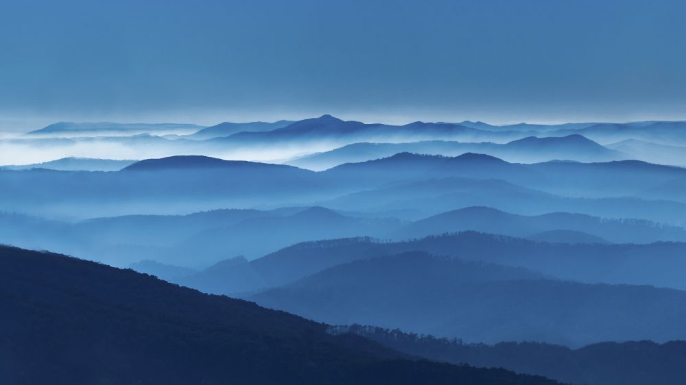
The Alpine National Park offers impressive walks, 4-wheel drives, and spectacular camping spots, where you can follow in the steps of mountain cattlemen. The high country landscapes and fearless heritage of the country cattlemen has ensured that the Alpine National Park boasts an enviable reputation of a must visit part of Victoria.
Whether you enter from above, along the Great Alpine Road, or start your journey on the lower sections, you'll find that you will be spoilt for choice. The rolling hills of Heyfield, Licola and Dargo give little indication of the spectacular gorges that dissect the south-east corner of the Alpine National Park.
Moroka and Bryces Gorge hide impressive waterfalls, while Mount Howitt, the Wonnangatta Valley and Tali Karng make for scenic settings to cross-country skiing, hiking, horse riding, deer hunting and four-wheel driving adventures.
Make your way along the 4x4 Moroka Hut Track, deep into the Alpine National Park. The Moroka Hut sits stoically at the edge of the Upper Moroka River, a scenic place for a pit stop.
The Bryce Gorge Circuit Walk (8km, near Licola) takes in the stunning ravine, open plains, woodlands and waterfalls, with views for days.
True adventure seekers can undertake the epic 655km Australian Alps Walking Track which will get you to Canberra via some of the country’s most remote alpine areas.
There’s only one way to stay overnight in the park: rough it. There are innumerable campsites in the heart of the majestic bush boasting to be among Victoria’s most magnificent. The sites are best suited to experienced hikers.
If you’re coming from Dargo, camping hot spots are located at Wonnangatta Valley (4WD access only), Eaglevale and Talbotville. From Licola, set up camp on the Wellington River beneath peppermint and manna gums.
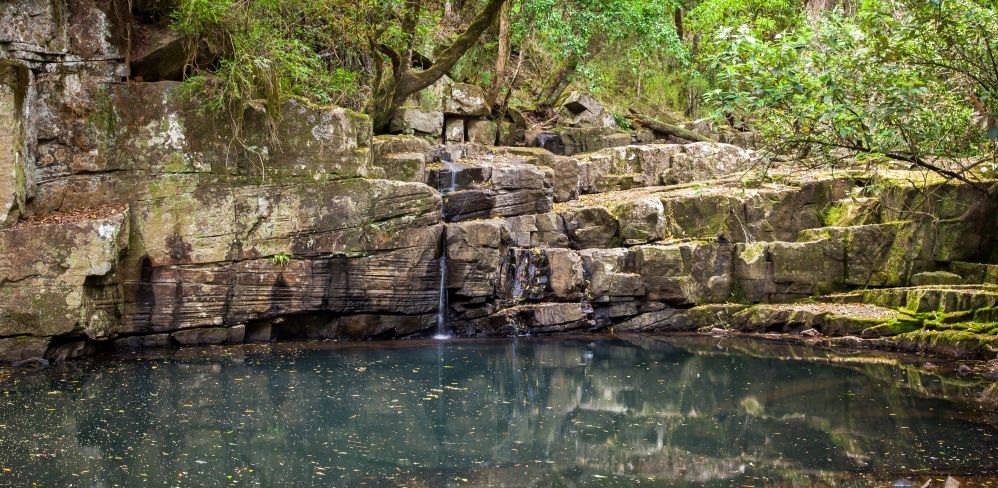
This idyllic setting in the middle of the bush has made Minneha'ha Falls a popular weekend destination. A rocky waterfall enclosed in a deep valley west of Yarram, remote but still within a few steps from the road and your campsite. Despite being only a relatively small river, in winter/spring there was a loud and powerful flow of water gushing down the near vertical rock face, into the pool below.
Directly in front of the falls there is a lawn area which makes a perfect spot to lay out a picnic blanket for an uninterrupted view of the falls from across the pool. From the adjacent car park you can also walk up a little track, past the water tank, and down the other side to the top of the falls.
Downstream of the falls next to the Albert River, you will find the campground with unpowered camping sites. The campsites are on relatively flat, open ground with a grassy covering, and come with their own fire pits and communal toilets.
The Knob Reserve in Stratford is part of the Bataluk Cultural Trail and is an important place for the GunaiKurnai people. The reserve is set on a 56 hectare site with a lookout platform affording views over local farmlands and the Avon River. The reserve is ideal for a picnic with barbeques, tables and chairs and a playground.
Migration routes used by the First People passed by what is now the Princes Highway, the Knob Reserve had sheltered campsites and was close to the river and fertile river flats that supplied plenty of good food and water and would have allowed large gatherings of clans from the GunaiKurnai nation to meet for feasting, corroborees and other ceremonies.
The current Knob Reserve walk loops around the park and takes in evidence of canoe trees and sandstone outcrops that would have been used to sharpen axe heads. At the crest of the hill, an easy walk from the car park, is a lookout platform where visitors can enjoy a panoramic view across the local farmlands, the foothills and the Avon River.