

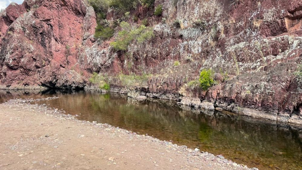
The Wellington River flows through parts of the Alpine National Park and Avon Wilderness Park joined by three tributaries including the Carey and Dolodrook rivers, and ending up at the Macalister River to the north of Licola. The river descends 820 metres over its 40-kilometre course.
Fishing:
Keen anglers are able to wet a line, with brown trout, European perch, and common carp among the most popular catch to be had.
Hiking:
Lake Tali Karng Trail
17 km each way, 7 hrs to Lake, 6 hours out
The Lake Tali Karng Trail begins along the Wellington River walking track at the third bridge over the Wellington River and at the Platypus camp, about 22 km north of Licola. The route follows the Wellington River upstream for 17 km, crossing the river 16 times. These crossings may be hazardous if the river level is high. The Clive Lanigan Track climbs steeply through the Valley of Destruction and onto the Lake. A slightly longer alternative route is via Riggall Spur Track up to Echo Point. From here it is a 1 km walk down to the Lake.
Lake Tali Karng hides deep in the mountains and is the only natural lake within the Victorian Alps. Held behind a rock barrier created thousands of years ago, the underground stream it feeds emerges at the infant Wellington River.
Camping:
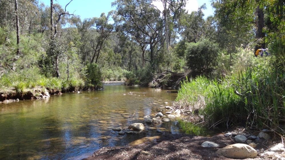
Just north of Licola on Tamboritha Road, there are 13 numbered campsites along the Wellington River. These sites offer amenities such as toilets, fireplaces, and picnic tables. You can enjoy camping beneath the shady trees with easy access to the river. Some of the notable campsites include:
The trip to Tali Karng is an adventurer's dream. Three walking tracks lead to the lake, ranging from 13km to 20km one-way. Whichever you take, you'll need to be fit and experienced, and have everything you need for a full day's walk on hand (see the Visitor Guide for more details).
Each of the tracks offers a different landscape to experience. Trek across Wellington Plains or ford the Wellington River. The remoteness of the area makes it a magnificent camping spot.
Make camp at Nyimba Camp near the southern end of the Wellington Plains walking track, or below the lake in the Valley of Destruction. Nyimba Camp has toilets and fireplaces.
Tali Karng is the only natural lake within the Victorian Alps. Held behind a rock barrier created thousands of years ago, the underground stream it feeds emerges at the infant Wellington River 150m below in the Valley of Destruction.
The first people to call this area home were the Gunaikurnai people, most likely members of the Brayakaulung clan. Aboriginal people guided many European explorers and gold miners through the mountains along well-used pathways, which now form some of today's road and track network.
Tali Karng is a sacred place to the Gunaikurnai and in keeping with their law, Aboriginal people are forbidden to go there.
Aboriginal people do not oppose non-indigenous people visiting Tali Karng as long as they treat the area with respect. Camping at the lake is disrespectful, so please treat the area with care as you pass by the lake and camp elsewhere.
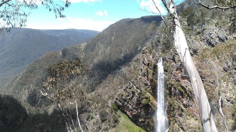
The Bryce Gorge Circuit hike starts at the carpark on the Howitt Road, 23.5km north of Arbuckle Junction (46.5 km north of Licola via Tamboritha Road). From the carpark follow the well defined track across open snow plains for about 1.7km to the waterfall on Pieman Creek. The best view is from a lookout about 50 metres beyond the sign.
Return to the main track and continue around the clifftops of Bryce Gorge for 2 km to Conglomerate Falls. From the falls the track follows Conglomerate Creek through Black Sallee woodlands and across open plains to a junction with the Wonnangatta Track. Guy's Hut is reached a further 3 km though groves of Snow Gums. Built in 1940, the hut is an excellent example of bush architecture and well worth a visit. Continue 1 km south east from the hut to the carpark.
Bryce Gorge Circuit is a 7.6km, Grade 3 hike located in the Alpine National Park, Victoria. The hike should take around 3 hrs to complete. For detailed trail info visit Bryce Gorge Circuit (7.6km), Alpine National Park, Victoria (trailhiking.com.au)
Overflow’s 4x4 Tours was formed to create unforgettable memories for their clients by exploring areas of the Victorian bush with their own 4wd vehicles. You will be in the safe hands of a qualified and vastly experienced guide that will get you off the beaten track and immersed into the serene bushland in the best places Victoria has to offer, from spectacular mountain peaks and raging rivers to stunning temperate forest and sandy beaches. From Novice to Advanced driver’s off road we have everybody covered. Your tour will have you camping among the wildlife in some of the most spectacular places the Victorian outdoors have to offer. Contact Dave your host for your tailored off-road adventure!
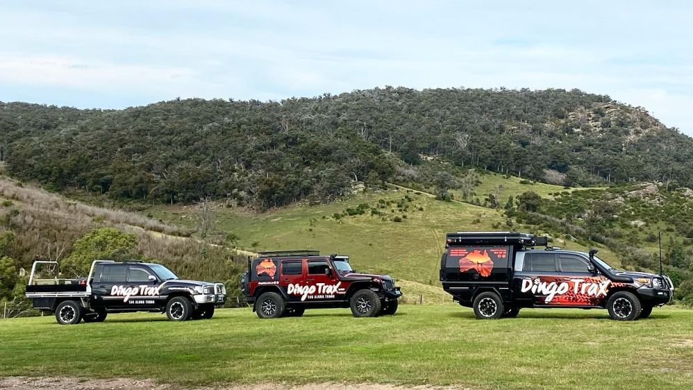
Dingo Trax Tag Along Tours are open to all levels of skill, ability and experience. Whether you’re a seasoned 4WD enthusiast or completely new to it all - and don’t quite have the confidence and know-how to go it alone - we have your back!
Our team offers years of experience and a passion for exploring the vast Australian landscape. When you combine this with a desire to help other 4WD adventure seekers experience all this great country of ours has to offer in the comfort of their own vehicle, you're going to enjoy one hell of an adventure you won't forget in a hurry!
Dingo Trax is ready to show the inexperienced adventurer how to get out and explore Australia’s remote wilderness in their very own vehicle. Whether it's by themselves, with a group of mates, or the whole family! We want to showcase the best this great country of ours has to offer in the safe hands of highly-skilled bushmen.
Some Dingo Trax adventurers will be surprised to know what their vehicle is truly capable of. At times, they might even feel completely out of their comfort zone. And that is completely natural. We’ve all been there.
What makes the world of difference is the team of experts who will be on-hand to guide them every kilometre of the way.
They will gain so much confidence and become at one with their vehicle after a Dingo Trax adventure.
The Thomson River rises below Newlands at the north western end of the Baw Baw Plateau of the Great Dividing Range, where it shares a watershed with the Yarra and Tanjil rivers. From its source, the river flows generally north, then east, then south southeast through its impoundment, then southeast, then east, and finally east by south, joined by seventeen tributaries including the Jordan, Aberfeldy, and Macalister rivers, before reaching the Latrobe River near Sale. The river descends 970 metres over its 170-kilometre course.
The river is impounded not far below its source by the Thomson Dam, creating Thomson Reservoir. The reservoir provides around 70% of Melbourne's water storage and supplies about 30% of Melbourne's water needs.This takes about 50% of the river's natural flow, which places a great environmental stress downstream. It particularly affects the Gippsland Lakes, which include Lake Wellington, Lake Victoria and Lake King. This area has international significance as a Ramsar listed wetland site.
Anglers can access the Thompson River at a variety of sections including at Sale, Cowwarr, and Heyfield.
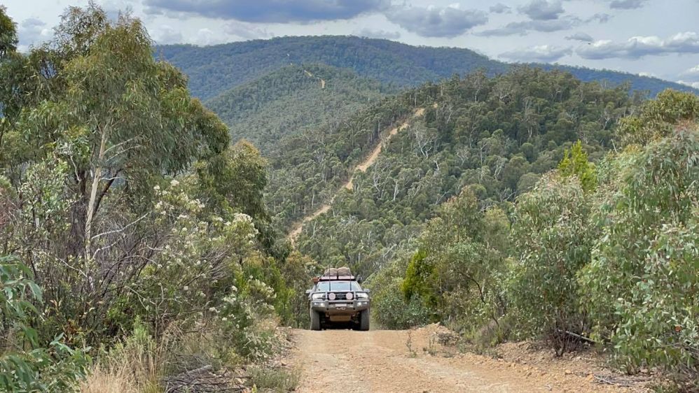
The Alpine National Park offers impressive walks, 4-wheel drives, and spectacular camping spots, where you can follow in the steps of mountain cattlemen. The high country landscapes and fearless heritage of the country cattlemen has ensured that the Alpine National Park boasts an enviable reputation of a must visit part of Victoria.
Whether you enter from above, along the Great Alpine Road, or start your journey on the lower sections, you'll find that you will be spoilt for choice. The rolling hills of Heyfield, Licola and Dargo give little indication of the spectacular gorges that dissect the south-east corner of the Alpine National Park.
Moroka and Bryces Gorge hide impressive waterfalls, while Mount Howitt, the Wonnangatta Valley and Tali Karng make for scenic settings to cross-country skiing, hiking, horse riding, deer hunting and four-wheel driving adventures.
Make your way along the 4x4 Moroka Hut Track, deep into the Alpine National Park. The Moroka Hut sits stoically at the edge of the Upper Moroka River, a scenic place for a pit stop.
The Bryce Gorge Circuit Walk (8km, near Licola) takes in the stunning ravine, open plains, woodlands and waterfalls, with views for days.
True adventure seekers can undertake the epic 655km Australian Alps Walking Track which will get you to Canberra via some of the country’s most remote alpine areas.
There’s only one way to stay overnight in the park: rough it. There are innumerable campsites in the heart of the majestic bush boasting to be among Victoria’s most magnificent. The sites are best suited to experienced hikers.
If you’re coming from Dargo, camping hot spots are located at Wonnangatta Valley (4WD access only), Eaglevale and Talbotville. From Licola, set up camp on the Wellington River beneath peppermint and manna gums.